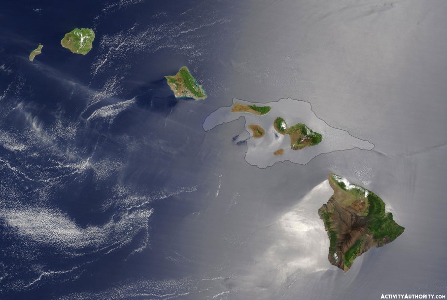
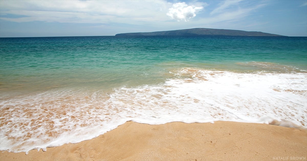
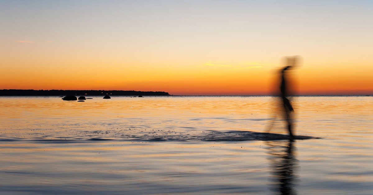
Spend a moment on one of the Valley Isle’s west or south side beaches—or peer out at the Pacific from a perch upcountry—and you’re bound to be taken with the beauty of Maui’s outlying islands, where on the clearest days, Kahoʻolawe, Lanaʻi, and Molokai appear close enough to touch.

Consider this: once upon a time, you could.
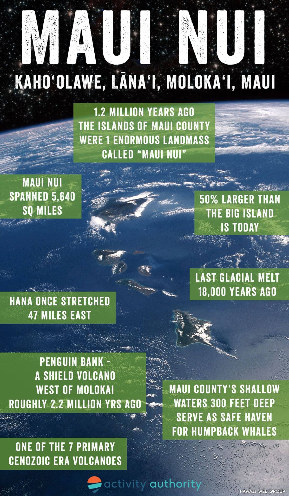
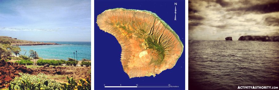
Approximately 1.2 million years ago, the four islands that today comprise Maui County were once connected in an enormous landmass dubbed “Maui Nui.” Translation? Big Maui.
And big indeed: according to geologist Harold Stearns—and, subsequently, scientists at the Smithsonian Institute and the University of California at Davis—Maui Nui spanned 5,640 square miles, rendering the land mass 50% larger than Hawaii’s formidable and aptly named Big Island.
Part of its vastness was due to Penguin Bank—a wide shoal, west of Molokai, that originated as a shield volcano roughly 2.2 million years ago. Once connected to the neighboring island of Oahu, the now coral-capped Penguin Bank encompassed an area eight times larger than the present size of Kahoolawe. Additionally, what we know today as the serrated coastline of Hana once stretched an additional 47 miles east, making Maui Nui a tremendous sight to behold (and now imagine).
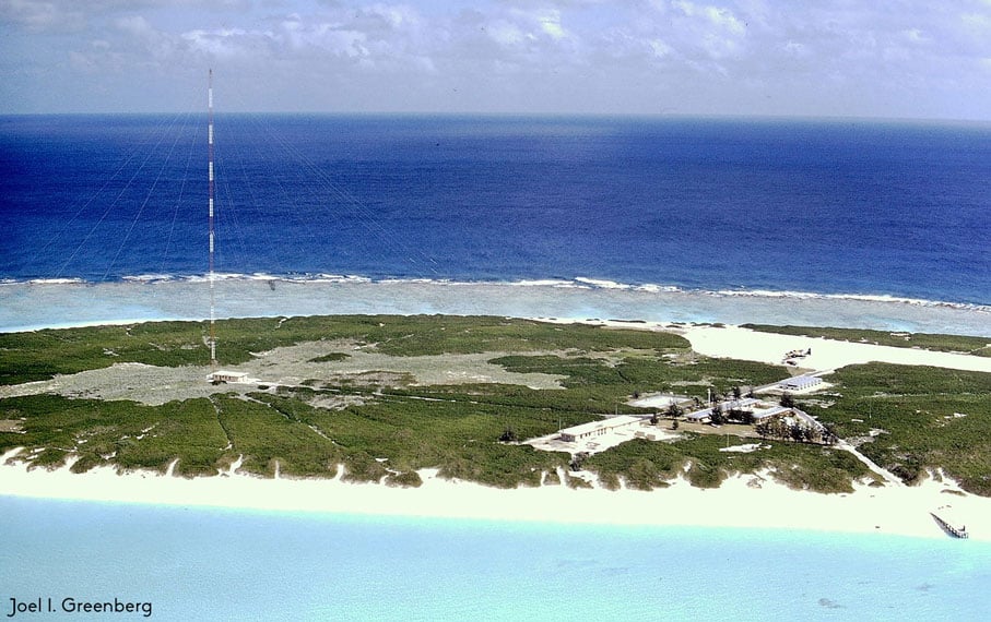
Together, these regions comprised what’s known as one of the seven primary Cenozoic Era volcanoes and part of the prehistoric Hawaiian-Emperor seamount chain, a largely-submerged mountain range that extends through the Pacific Ocean in a series of atolls, shallows, banks, and reefs to the Kure Atoll in the northwest, which is perhaps best known as housing hundreds of thousands of seabirds.
Over time, however, the flatter regions between the volcanoes that created the four distinct islands we now recognize as individual landmasses became submerged in a process known as subsidence: the weight of the shield volcanoes, which causes the underlying oceanic crusts to stoop under pressure, coupled with erosion and rising sea levels, flooded the saddles between the islands, leaving much of its original volcanic activity underwater.
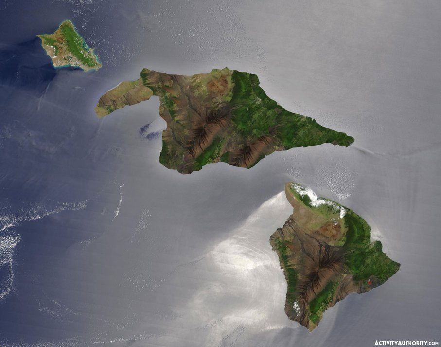
The connection between Penguin Bank and West Molokai broke, while what’s called a “permanent embayment” detached East Molokai from the Western Maui we know today as Lahaina, Kaanapali, Napili, and Kahana. This was followed by a rush of water that inundated the connection between East Molokai and Lanai, turning the bridge between the two obsolete. The latest glacial melting—around 18,000 years ago—left only the islands we know today as Kahoolawe, Lanai, Molokai, and Maui exposed; some scientists speculate that a similar process will divide the Big Island, separating zones according to the mountains that preside over them: Mauna Kea, Mauna Loa, Hualalai, and Kohala.
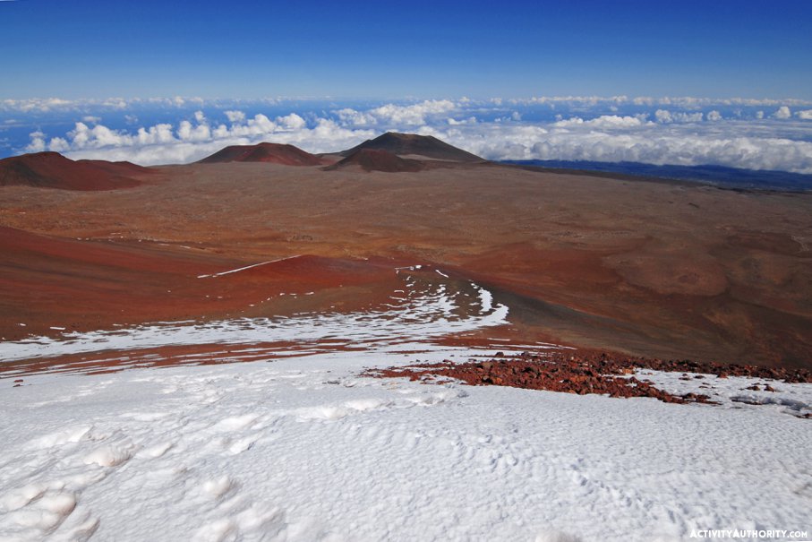
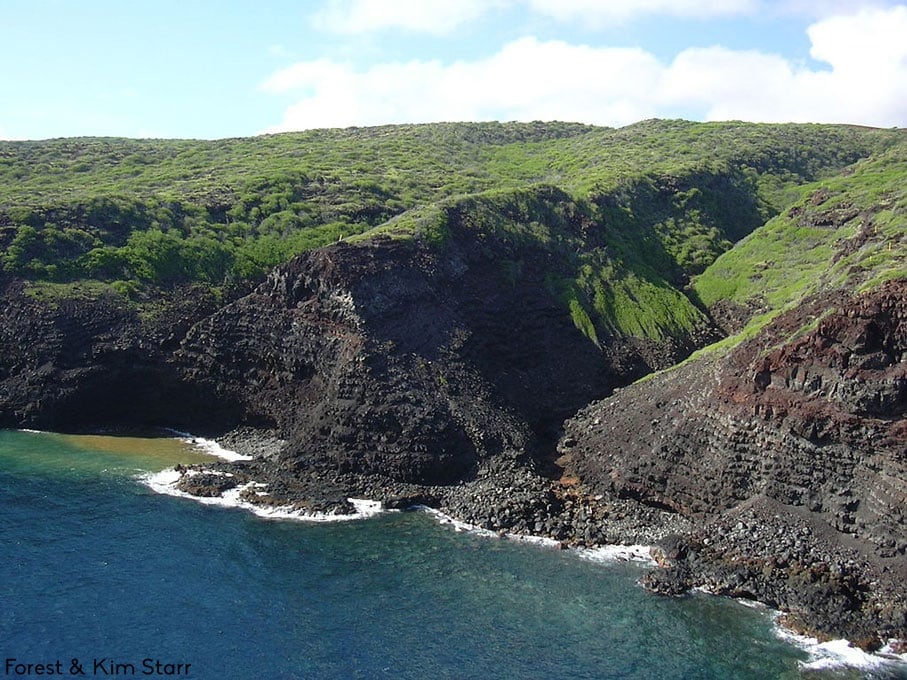
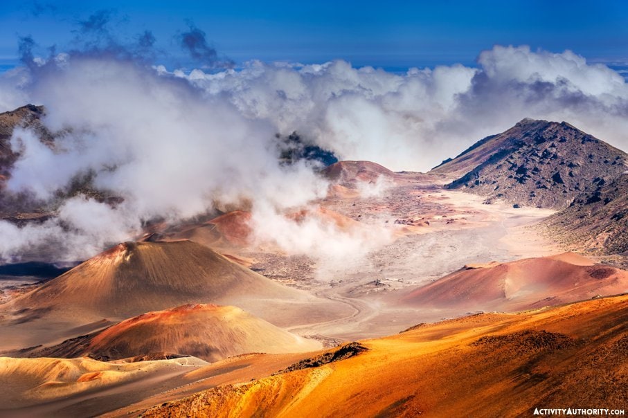
While Maui’s Mount Haleakala’s imposing height and sheer immensity suggests an incredible age, it’s the youngest volcano to contribute to Maui Nui, with its most eruption dating back as early as 1790. The cavernous caldera that serves as the crowning jewel of Haleakala National Park today is considered to be the enduring effect of two massive landslides to the north and south of the peak. Consider this and all of Maui County’s history to be symptomatic of Hawaiian shield volcanoes in general: each goes through a series of eruptive stages that renders their latter phases susceptible to the very landslides and erosion that make them vulnerable to disappearing underwater, and yet also gives them the vertiginous cliffs, gorgeous reefs, and stunning coastlines we honor and adore.
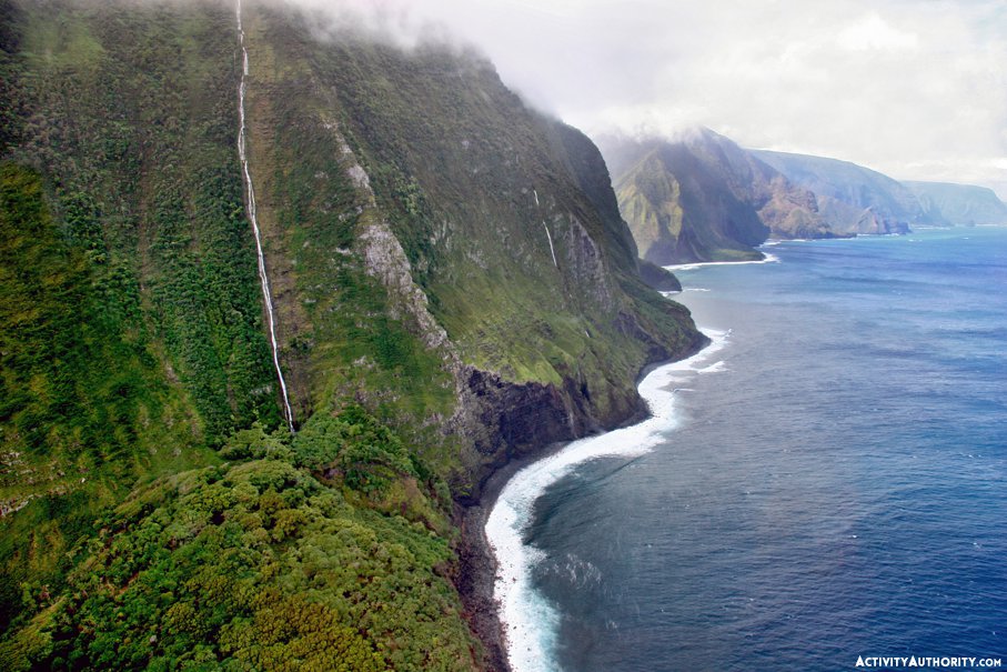
Modern-day Kahoʻolawe is evidence of the Hawaiian shield volcano’s phenomena. Red-hued and squatter than most islands in the Hawaiian archipelago, Kahoʻolawe’s eastern half fell during a cataclysmic landslide. And Molokai—otherwise known as the Friendly Isle—lost a significant part of its land mass when its summit caldera was split by a colossal landslide that sent half-mile-sized blocks up to 100 miles north of the island and ultimately created what we know today as the steepest sea cliffs on the planet.
But, while seemingly catastrophic, Maui Nui’s separation could easily be considered a boon for humans, plants, and animals.
Each island now holds its own special brand of charm. Commonly called Maui No Ka Oi, the Valley Isle is home to one of the most spectacular rainforests on Earth, while its geological evolution has left half of the entire island within a five-mile radius of the coastline. Lanai may be considered Ellison’s Island now, but it once served as the largest pineapple plantation in the world. Molokai—lush, beautiful, and chill—became a leprosy colony during Kamehameha the Great’s reign, housing over 8,000 lepers during the epidemic’s peak. Kahoolawe—uninhabited and the smallest island in the Hawaiian chain—served as a training ground and bombing site during World War II and continued to be used as for live fire-training exercises until 199o; today, it’s used exclusively for native Hawaiian cultural and spiritual practices.
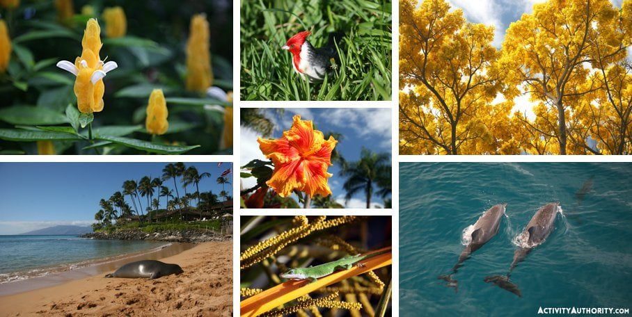
Additionally, the flora and fauna that existed on the giant land mass known as Maui Nui have survived rising sea levels, indeed providing rich, ample environments for several species to evolve. Such a range has contributed to Hawaii’s remarkable biodiversity. And should you need further evidence that Maui County was once a huge land mass, consider this: flightless ibises were found on both Molokai and Lanai, while a single type of flightless duck has been discovered on Maui, Molokai, and Oahu (perhaps explaining the name of its original bridge, Penguin Bank).
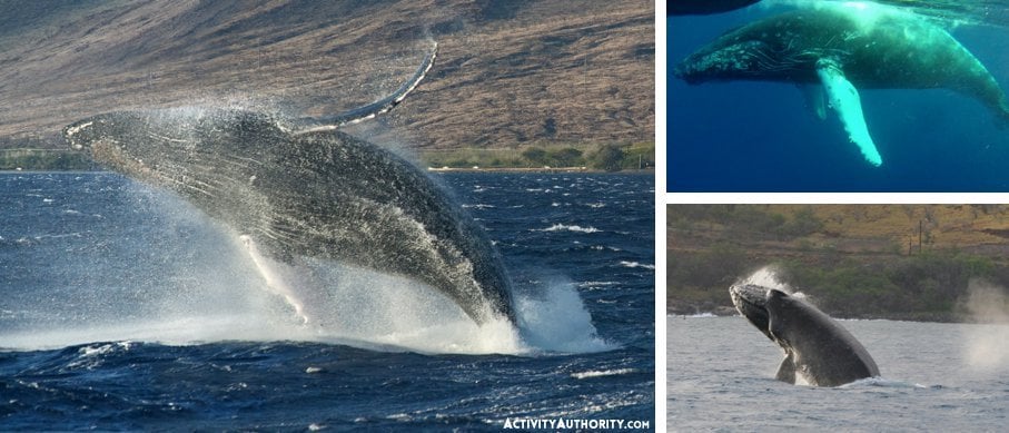
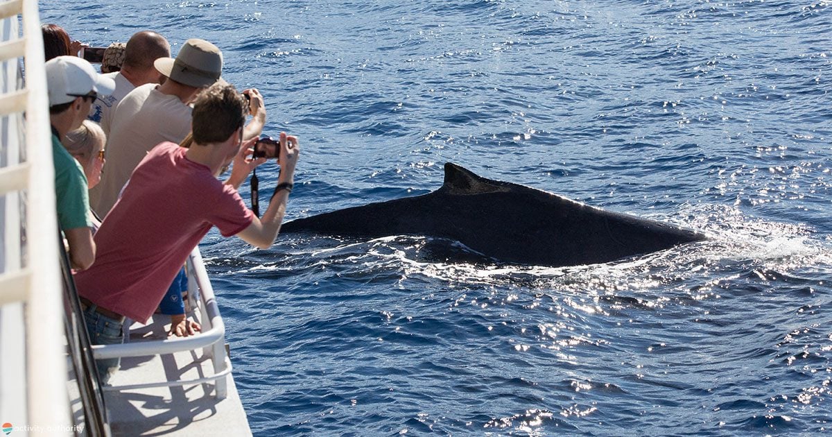
But the biggest blessing of Maui Nui’s division might just be the fact that it created a sanctuary for the North Pacific Humpback whale. Every year, between November and May, these enormous beauties (as in, up to 50 tons) migrate from Alaska to Maui’s warm waters to “winter” Hawaiian style, in large part because the waters between the four islands drop only 300 feet deep—rendering the region a safe, protected bay that’s free of predators and perfect for nursing newborns.
Think Maui is small by today’s standards? Think again. Due to its geological history and vulnerability to further erosion and sea level changes, scientists estimate that Haleakala and West Maui (built by the now-extinct Mount Kahalawai) will become distinct islands in roughly 15,000 years. Maui 2.0, or, rather, Maui Iki—as it’ll be truly small kine.


Excellent, Informative – I just wish the visitors would understand and respect this Aina – Kai of Hawaii. Along with a visitor industry in which in my opinion and daily observations would also think of this fragile existence instead of $$$$$$$$$$$.
As a speaker, writer over the past 4 plus decades I’ve witnessed the decline of respect.
Mahalo once again, as a one man endeavor over the past 4 plus decades I shall continue – in my presentations influence more to become aware of the fragility, and sensitivity of Hawaii and of ALL LIFE.
Me Ke Aloha Pumehana
With Warm Aloha
Excellent reading.. my son taught me so much about Maui and this just adds to the infirmation….thx.
Tell me how to get there….best airline to book….im soooo there already
To get to the Maui Nui of the past, a time machine would be required. To visit Maui these days, Virgin is good, Hawaiian is good too.
I was *impressed* with the Nuuanu Pali Lookout at 10 years old in 1963. This was before plate tectonics was even a “thing” and I was even then fascinated by these sharp, precipitous ridges plunging thousands of feet straight down, I attributed it to what the adults said, “…It’s the WINDWARD side of the island!” but even then, I went, “How come it’s not so windy now? How could just WIND do THIS??”
I always suspected there was more to the story, and I’m really happy that half a century or so later, some of my young questions are being answered.
Note: I said, “Some.” 1963 was the year they shot that guy. Still waiting.
Thank you for your effort and information! \\//_
If only the First Missionaries had taken their” Good Book ” elsewhere and left the Hawaiians to their own Destiny. Every early Ships that visited the Hawaiian Islands devastated the Hawaiian Population with Decease and Greed. Maui is a perfect example of what the First Missionaries did when the opportunity arrived to owning Land from the Hawaiian people. They made sure ” Legal Documents ” were used during transactions which the Hawaiians were not educated in. Sad to say they were Ripped OFF.
Say it like it is
you done?